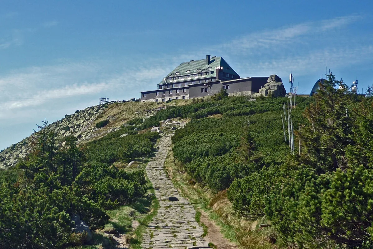
A 1,362 m peak in the western Karkonosze above Szklarska Poręba, reachable by cable car, with a viewpoint and a shelter on the summit.
Szrenica is a peak in the western part of the Karkonosze, right by the border with Czechia, south of Szklarska Poręba. It stands 1,362 metres above sea level and belongs to the Crown of the Mountains of Lower Silesia.
The German name of the peak was Reifträger. The Polish name Szrenica was given in 1949. It is probably linked to "szron" (hoar frost), a type of recrystallised snow cover found in the Karkonosze.
The peak rises 60 metres above the main ridge of the Karkonosze, known as the Silesian Ridge, and the summit itself lies entirely on the Polish side of the border. From Szrenica there is a view of the Jelenia Góra Basin, the Izera Mountains and the Czech part of the Karkonosze. A viewpoint has been marked on the summit, with a commemorative stone set up there.
Today's shelter building was constructed in the 1920s. Its first owner was Franz Endler, who moved here from the Czech Endlerbaude shelter after the First World War. The official opening took place on 19 December 1922, and until 1945 the building was called Reifträgerbaude.
A two-section cable car leads to the summit: Szrenica I is 1,417 metres long and Szrenica II is 1,341 metres. The lower station stands at ulica Turystyczna 25a in Szklarska Poręba, at an altitude of 710.8 metres above sea level. The whole route measures about 2,393 metres, with an elevation difference of over 508 metres, so the upper station sits at 1,309.6 metres, just below the summit. The cable car began operating in 1962 as the second mountain lift in the Polish Karkonosze, three years after the one to Kopa in Karpacz. It initially used single-seat chairs, replaced in the 1990s by two-seat ones.
From the summit it is a short way to Łabski Szczyt and the Kamieńczyk Waterfall. Further along the trails are also Śnieżne Kotły and Wielki Szyszak, and towards the border, Czeskie Kamienie.

Be the first! Add a comment.
You need to log in to add a comment.
Log in