
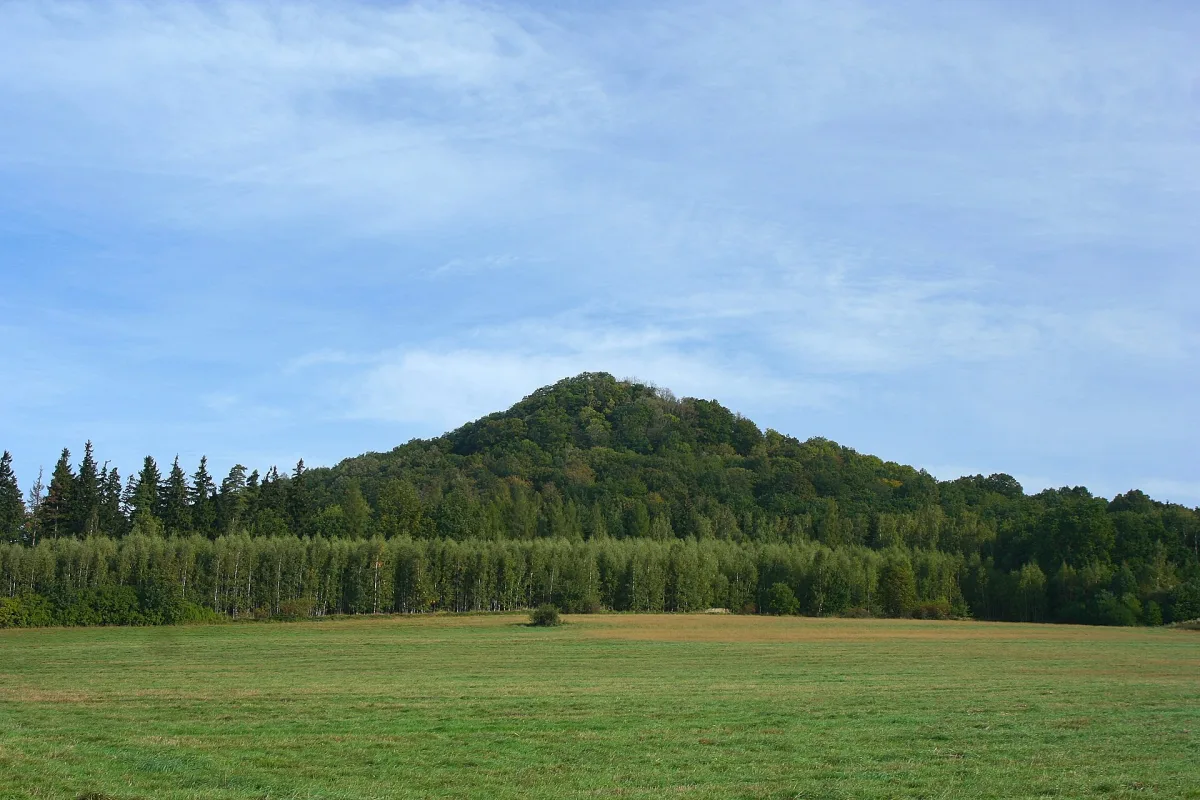
Volcanoes that went extinct over half a billion years
The Kaczawa Mountains and the Kaczawa Foothills did not have a single volcanic period, but several, separated from each other by tens and hundreds of millions of years. The oldest traces of volcanic activity in this region date back to the Palaeozoic, roughly 500 million years ago. The next phase fell at the turn of the Carboniferous and Permian periods, around 250-300 million years ago - this is when lava cooled inside volcanic vents, the same lava that today forms the famous rock "organs". The youngest eruptive episode, already in the Cenozoic era, took place in the Miocene, around 30 million years ago, and it is to this episode that the cone-shaped hills visible today above the surrounding villages owe their shape. Between these episodes the region was at times a sea, then land covered with sediments, and the volcanoes went extinct and sank into the earth for tens of millions of years before eruptions returned elsewhere.
What is left of the volcanoes in today's landscape
What is left in the terrain of the long-extinct volcanoes is mainly their "insides", because the soft layers of ash and tuff were worn away by erosion, while the harder lava that solidified in the vents was not. The result is the characteristic cone-shaped hills called volcanic necks, that is, exposed vents of former volcanoes.
The best known is the peak of Ostrzyca Proboszczowicka, known as the "Silesian Fuji" for its regular, cone-like shape. It is the remnant of a volcanic vent built of basalt columns, reached by several hundred stone steps. Czartowska Rock near Pomocne has a similar character - a small, slightly bent hill built of basanite, cut into on two sides by former quarries. It was precisely this quarrying that exposed a fragment of the volcanic vent there, with cracked, regular rock columns, today clearly visible up close.
A basalt hill also carries Grodziec Castle, built on top of a former volcano 389 metres above sea level - the castle's builders in the 12th century made use of the natural, steep shape of the terrain, not yet knowing they were standing on an extinct volcano. Quarries, which in many places partly destroyed such hills, paradoxically make them easier to view today - it is precisely in the walls of former workings that you can see most clearly how a volcanic vent is built from the inside: regular, polygonal rock columns, arranged vertically one next to another.
Geopark: what exactly the status means
A geopark is an area protected not for its plant life or animals, but for its geological structure - in this case, for the traces of several volcanic epochs concentrated in one place. The core of this area, the eastern part of the Kaczawa Foothills, has been protected since 1992 by the Chełmy Landscape Park, the first park of this kind created back in the former Legnica Voivodeship. The geopark itself covers a wider area of the Kaczawa Mountains and Foothills, stretching between Jelenia Góra and Legnica.
In 2024 the area received UNESCO Global Geopark status, becoming the third geopark of this kind in Poland. This is a separate category from the UNESCO World Heritage List, known for listing individual monuments - a UNESCO Global Geopark recognises the value of an entire area as a coherent geological story and requires the region to educate, protect and make this knowledge available to tourists, but it does not protect individual sites separately the way a World Heritage listing does.
Places to see, in order
The main route through the geopark is the yellow-marked Trail of Extinct Volcanoes, running for around 100 kilometres between Złotoryja and Legnickie Pole. It is worth planning a visit along it, starting from the Złotoryja side:
- Ostrzyca Proboszczowicka - the geopark's most recognisable cone, the "Silesian Fuji", with a nature reserve on its slopes.
- Czartowska Rock near Pomocne - a smaller volcanic neck with columnar jointing visible in a former quarry.
- Wielisławskie Organs near Sędziszowa - a rock wall with columns resembling organ pipes, one of the geopark's landmarks.
- Grodziec Castle - a stronghold on a basalt hill, with views of the surrounding volcanic cones.
- Basalt Hill in Jakuszowa - with a wooden observation tower, from where several other post-volcanic hills can be seen at once.
Towards Legnickie Pole the trail continues through further hills and former quarries, including places once known for basalt extraction used in construction - some of the stone from these hills even went into the building of the Warsaw metro.
Geological paths and how to read them
Besides the main geopark trail, several shorter, themed geological paths lead in a loop around a single site and explain step by step what you are seeing. One example is the "Around Wielisławka" nature and geology path, which takes around an hour to loop around the hill with the Wielisławskie Organs.
Information boards along such paths usually describe each stop in three layers: what can be seen in the terrain (for example a rock wall or a former working), what rock the site is built of and through what geological process it formed, and how old what you are looking at is. It is worth reading them in the order of the numbered stops, because successive boards often refer back to earlier ones - only taken together do they explain why a cone in one place differs from a wall of columns in another, even though both formed from the same volcanic history of the region.
Be the first! Add a comment.
You need to log in to add a comment.
Log in